Prochain point : lat="49.064916" lon="1.730082"

The brooks of Vienne-en-Arthies
Water for human activities
When Vienne brook...
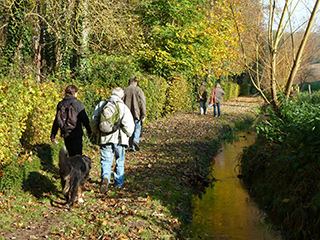
Vienne-en-Arthies is what might be called a "water town". Numerous streams run through the village, brightening the streets with their babbling sound.
Vienne brook rises in the Vallée du Roy and splits into two sections just before entering the village. Its natural course runs through Champs Crosniers and comes out at the bottom of the village to form a ravine that drains the valley bottom and receives excess water, in the event of flooding.
The artificial course, which is the chanelled brook from the Vallée du Roy, is a millrace built by man to power the mills. As it passes, two streams flow into it from Saint-Cyr-en-Arthies.
The two arms of Vienne brook then continue in parallel to Millonnets. The millrace powers the Moulin du Paradis (Paradise Mill), then the Moulin de Pierre (Stone Mill) and finally Moulin Madame (Madam Mill).
... Joins Chaudry brook
Chaudry brook runs down from Villers-en-Arthies, through the hamlet and past the mill and then splits into two momentarily. It has been diverted to flow past a second mill, before joining the ravine at the Moulin de la Cavée (Sunken Path Mill). Leaving Millonets, the natural brook from the Vallée du Roy and the channeled brook run through Vétheuil and flow separately into the Seine.