Prochain point : lat="49.025051" lon="1.916739"

Panorama of the town of Tessancourt
Former Latin name: Taxicurtis
As evidenced by archaeological finds, the site of Tessancourt was inhabited in Neolithic times. Occupation seems to have been continuous until the Merovingian period. In Taxicurtis, the ancient Latin name of the village, there is "curtis" meaning farmyard, defined as a farm representing the core from which the village developed. The name Tessancourt was first mentioned in a 1055 charter when the count of Meulan, Galeran I, donated his lands to Jumièges Abbey. Ten years later, his son, Hugh, granted them to Bec-Hellouin Abbey, to which the monks of Saint-Nicaise of Meulan were attached. They drained the marshes and cultivated the land.
Hillside vineyards
From the thirteenth century, vines were cultivated in Tessancourt. In this parish, wine growing developed steadily. The subsoil, limestone on the western slope and more clayey soil on the eastern side, lends itself perfectly to vines. In 1136, Robert, Count of Meulan donated various parts of Tessancourt to Liancourt church. To comply with the donor's wishes, and according to a Chapter Act of 1232, the monks of Saint-Nicaise decreed that "the red and white wine of Tessancourt vineyards will now be entirely for use by the community and neither sold nor subtracted”.
The town of Tessancourt-sur-Aubette was partly planted with vines until an epidemic of phylloxera broke out in the nineteenth century, destroying the vineyards.
The small chestnut woods at the top of the hill are a reminder of the use of this rot –resistant wood for poles and barrels.
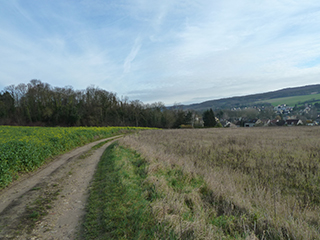
Landscapes that tell the story
Each element of the landscape, whether farmland or woodlands, makes up the panorama. It is the result of a slow process of evolution. The hilly terrain was first shaped by the flow of the Aubette Meulan River which runs through the village. As the river carved out the valley, it left the alluvial deposits that favour market gardening. The valley floor, whose vegetation reveals the presence of water and wetlands, forms a green corridor now dedicated to sport and recreation. The agricultural land is located on the slopes or on the plateau. The outcrop pattern in the background behind the village is formed by the forest of Hautil planted with chestnut trees; it extends over 1,250 hectares between the Seine valley and Cergy-Pontoise.