Prochain point : lat="49.015743" lon="1.944618"

The enclosed gardens
The evolution of the urban fabric
A historical centre...
In the Middle Ages, the village grew up on a hillside, around the church and the priory. The rural houses and little farms spread out along the Rue Adhémar (named after the countess who donated 20 hectares of pasture land to village in December 1793). After a number of land transactions, the seigniory took shape and the village was remodelled around the estate. This old layout can still be seen today in the narrow, winding streets. Building continued into the mid-twentieth century.
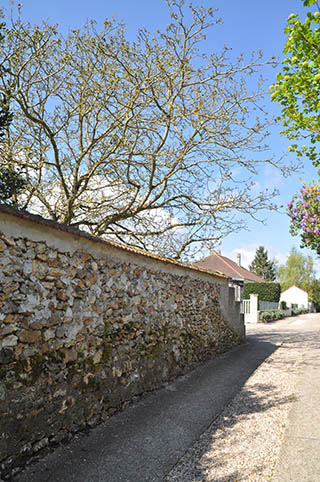
...preserving the enclosed gardens
The enclosed gardens are still clearly visible in the road structure of the commune. They consist of plots of land enclosed by hedges or walls of stone or gritstone, either coated with plaster or with the bare stones showing through. Standing about 1.5 metres high, these walls not only marked out the plots but, above all, helped protect the crops from the wind. They are an inherent part of the commune's rural identity and mark the continuation of the built-up area.
The first mention of the Clos Vaudry dates from 1767 but the name may derive from an older source and be a reference to Nicolas Vaudry, the priest of Evecquemont and landowner in 1733. Known either as 'clos' or 'enclos' in French, it belonged to several owners, and served as a garden for the terraced houses. In 1817, it covered an area of approximately 64 ares (6,400 m²) serving as a vegetable garden with vines and fruit trees. The Clos Vaudry was progressively divided up into plots from 1950 onwards.