Sentiers du Patrimoine ®
Ableiges
Le Hameau de La Villeneuve-Saint-Martin

Traverser pour prendre en face la rue de l’église. Revenir à l’entrée de la Villeneuve par les rues Paul Cézanne et François Vaudin (ou par les rues du stade et Georges Brassens). Suivre le cheminement pour revenir de l’autre côté de la 2 x 2 voies. Emprunter le même chemin qu’à l’aller pour regagner Ableiges.
Prochain point : Lat. 49.089622, Long. 1.981864
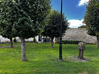
Likely of medieval origin, La Villeneuve-Saint-Martin was an independent village until 1834. It is organised around a main axis, today’s Rue François Vaudin, which was once a section of National Route 14, itself following the route of the former royal road from Paris to Rouen. This major thoroughfare was probably key to the village’s development, with most buildings located along the roadside. Near one of the village entrances, a 19th-century wayside cross made of stone marks the junction with the Rue Maurice Ravel. A nearby coachman’s plate also bears witness to earlier 19th-century road signage.
Outside the built-up core, the territory of La Villeneuve-Saint-Martin consists mainly of fields, benefiting from a favourable environment on the plateau. Many of the buildings along Rue François Vaudin are former farms, smallholdings, or rural houses. They form a fairly continuous frontage, particularly on the south side of the road. The old farm at the village entrance is clearly visible on the 1834 cadastral map as a group of buildings arranged around a square enclosed courtyard—a typical model of a Vexin farm.

